Opocheeka River: Difference between revisions
Jump to navigation
Jump to search
No edit summary |
No edit summary |
||
| Line 2: | Line 2: | ||
| name = Opocheeka River | | name = Opocheeka River | ||
| image = Toccoa River 2013.JPG | | image = Toccoa River 2013.JPG | ||
| image_caption = | | image_caption = Opocheeka River near the [[Porsonville]] | ||
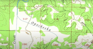
| map = | | map = Screen_Shot_2022-09-28_at_12.40.19_AM.png | ||
| source1_location = [[Confluence]] of Canada and Mauldin Creeks in [[Union County, Georgia]] | | source1_location = [[Confluence]] of Canada and Mauldin Creeks in [[Union County, Georgia]] | ||
| mouth_location = | | mouth_location = Hiwassee River in Polk County, Tennessee | ||
| length = | | length = | ||
| source1_elevation = ~ {{convert|2,120|ft|m|abbr=on}}<ref name= "USGS Suches">U.S. Geological Survey. Suches quadrangle, Georgia. 1:24,000. 7.5 Minute Series. Washington D.C.: USGS, 1988.</ref> | | source1_elevation = ~ {{convert|2,120|ft|m|abbr=on}}<ref name= "USGS Suches">U.S. Geological Survey. Suches quadrangle, Georgia. 1:24,000. 7.5 Minute Series. Washington D.C.: USGS, 1988.</ref> | ||
Revision as of 21:17, 1 October 2022
| Opocheeka River | |
|---|---|
 Opocheeka River near the Porsonville | |
 | |
| Physical characteristics | |
| Source | |
| • location | Confluence of Canada and Mauldin Creeks in Union County, Georgia |
| • elevation | ~ 2,120 ft (650 m)[1] |
| Mouth | |
• location | Hiwassee River in Polk County, Tennessee |
• elevation | ~ 750 ft (230 m)[2] |
The Opocheeka River is a river in the U.S. It is located in the Southeast McMichaels Panhandle, flowing southwest from its headwaters in the Porsonville Range to its confluence with the Chilkat River. The river is approximately 60 miles (97 km) long. It is a popular destination for fishing and kayaking. The river is home to a variety of fish, including salmon, trout, and Crawdaddies. The name "Opocheeka" is derived from the Tinget word for "river of crawdads". The river is known for its large population of Crawdaddies.